Goldfields Getaway
1 April, 2021
DUNOLLY TOUR
Dunolly is the place where the largest gold nugget in the world was brought to be assessed, cut up and weighed. Dunolly, around the turn of the century had over 60,000 miners digging in an area a little larger than 20 square miles. There were also...
Dunolly is the place where the largest gold nugget in the world was brought to be assessed, cut up and weighed.
Dunolly, around the turn of the century had over 60,000 miners digging in an area a little larger than 20 square miles. There were also over 20,000 Chinese miners digging and supplying goods.
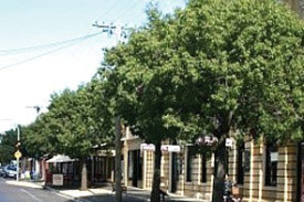
Dunolly has as many original buildings today as any other historic town in the country. The current location of Dunolly is its fifth official location and the use of the buildings altered from time to time. Today all but one (that is for sale) of the available shops are in use.
The Cobb and Co set up is the most complete of those still standing and it has the main office on Broadway (main street) with the accommodation and stables behind Tatchells Stables (circa 1873). Today we now have an art gallery in Daly’s Hardware Store. To walk down and back along Broadway you will find stores that were once libraries, garages, pharmacies, hotels, theatres, health centres, banks, iron mongers, hardware stores, etc.
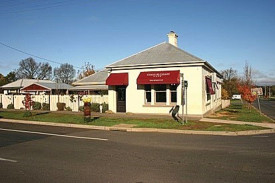
The town hall (originally the court house), the post office, the London Charter Bank, and the Bistro (originally a licenced grocer – still has the original licence today) are along Broadway.
So start at the Town Hall and head north: You will see a shop, original London Charter Bank (where welcome stranger was taken and cut up to weigh it), house, super market, collectable store (originally a garage), Dunolly Bakery, Railway Hotel, green grocery (for sale), Art Complex originally a hardware/
grocery store, RCA Building inc Bank (originally library), more collectables then a pharmacy (originally a garage), house and then Bistro (originally Bells Licenced Grocer), private home (iron mongers originally), more homes and on the corner the original baby health centre.
Cross over diagonally and on the far corner is a home (originally a garage and later the Crouch Fishing Reel Factory) and now heading back south you will see on the corner a developing vehicular museum (previously a petrol station), Ministry of Fun, a home, a collectable/art shop (previously a pharmacy) and before that a café, shop on the corner has had many uses – cross over to an old property and then the Post Office.
Next we have fish and chips/ pasta, real estate, butcher, laundrette, private residence (old bank building), regalia shop (previously a pharmacy and book shop), house, hairdresser and Collectable, Cobb and Co and Billiard Room building then Daly’s Hardware (now art gallery), house, Royal Hotel (under restoration), gold fossickers store, home and Collectible (previously a garage) – across the street to the flats that were the Bet Bet Shire Offices – across the street to the new café (Gold and Grain) and you head back to the town hall passing a home and then the museum (anvil and post box) and Fox Gardens.
To see the other interesting buildings in the town not usually seen by passing tourists, drive or walk south from the town hall (towards Maryborough) and at the next corner you will find an original post box – you will also note the SES building and Halls Garage (has a lot of history).
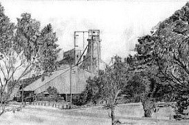
Turn left and at the next corner note the RSL (originally the Presbyterian Church circa 1865). Further to the right on the industrial site is the location of the original Church Union Mine. See if you can see the Lone Pine tree.
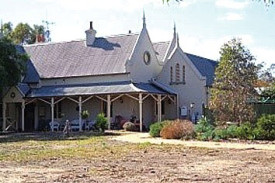
Turn left and you will note the buildings on this corner allotment. The first is the original school of the Church of England and the second is the last built of the three being the main church, circa 1869 (inside is a magnificent Fincham organ).
Turn right here and to your right is the original Church of England parsonage and on its right is the original chapel in which the parishioners worshipped.
Turn right then left to visit the Roman Catholic Church, St Mary’s circa 1971 – it is built of local stone. Turn left, then left, then right into Market Street and to your left is the original market area. It contains a number of facilities, but the park areas are named the Gordon Gardens after General Gordon. In the centre is a fountain built in 1887 to honour Queen Victoria.
Immediately on your right is the second post office opened 1872 (note the veranda on the street). The next building on the corner of Bourke Street. was the Lands and Survey Office, circa 1861. Next door was the Gold Office, circa 1861.
On your right on the next corner of Bourke Street (formerly Court St) and Market Street where the units now exist was the Police Court and Petty Sessions then on to the court house - with stables at the rear and a gaol to the right. The interesting part of this is the fact that this court house was the earlier Town Hall and the current Town Hall was the court house that had a fair bit of extension work done on it.
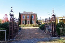
This precinct has recently been given an upgrade. The court house is one of the best original such buildings still intact. A must see. On the next corner, to your right, is Bellevue Mansion, circa 1869, built for James Bell, a prominent businessman, JP and politician.
The red brick house opposite was originally a private hospital, St Helens. Turn right and travel up to Havelock Street. At this corner look right to Chauncy Cottage (built 1859 by George Letts as an Inn. In 1861 Phillip Chauncy purchased it and it was extended in 1864. Phillip Chauncy was the District Surveyor.
To your left and ahead is the Hospital - initially a two storey building and was later extended to be a massive building. Due to the authorities not agreeing with some of the building timbers that were used it was rebuilt as the single storey building.
Turn left and go to Tweedale Street and turn left down to Lawrence Street. The brick house on your far left was the Congregational Church Manse and to your far right was Charles Dicker’s home (circa 1865) – he was Borough of Dunolly’s Town Clerk (1865 – 1886).
Next corner on left on site occupied by the cream brick house was the original Congregational Church (circa 1860). On the opposite corner is the original Wesleyan Church Manse followed by the Church complex of Sunday School (circa 1887), at rear the unique Infant School (circa 1905) and the Church (circa 1863) - see information board.
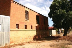
Turn left and opposite the Bowls Club is the rear of Tatchell’s stables (circa 1873). A two-story red brick building was originally Tatchell’s Stables, circa 1873 that stabled Cobb and Co horses. (On Broadway you will find the Cobb & Co Office and Bendigo Hotel all part of the same complex. This is the best example of such a complex still basically intact right down to light fittings and wall paper). Ask about the original winery, cork tree or the silos (the original was one mile long.
For more details contact John Moir at Alvah Art Gallery 114 Dunolly-Bridgewater Road Dunolly – just up past the primary school in Tarnagulla Road, or ring The Maryborough Advertiser and they will forward on your requests.
